The images below illustrate water diversion and damming activities along the Teesta River at Gajoldoba (Latitude: 26°45’14.36″N and Longitude: 88°35’23.80″E), affecting water flow from India into Bangladesh. Let me explain each figure based on the visible descriptions:
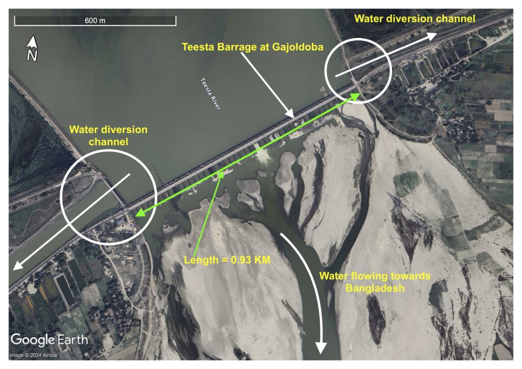
Figure 1: Teesta Barrage at Gajoldoba, India. Imagery date: 08 April 2023. Source: Google Earth Pro.
Figure 1 shows the Teesta Barrage located at Gajoldoba. The water diversion channels on both sides of the barrage are clearly marked, which redirect water from the main river flow. There is a visible portion where water is still allowed to flow downstream towards Bangladesh, but a significant amount of water is being diverted before reaching Bangladesh. The length of the barrage is noted as 0.93 km. The diversion of water reduces the natural flow of the river downstream, contributing to reduced water availability in Bangladesh, particularly during the dry season.
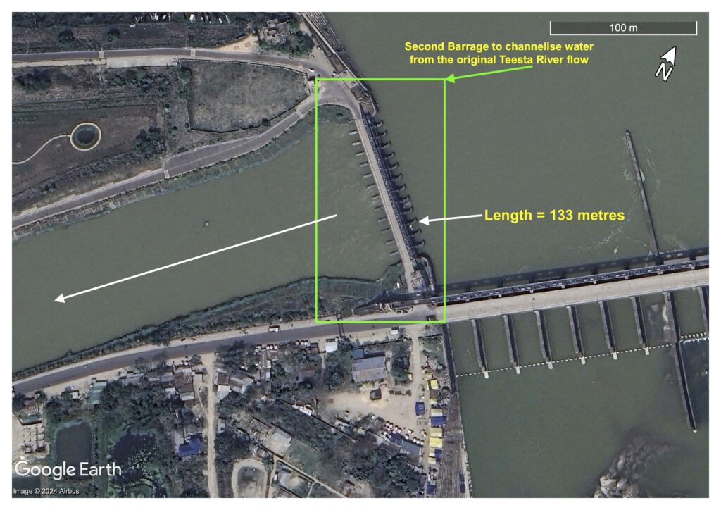
Figure 2: Inlet water control structure at the Teesta Barrage, diverting water towards the Mahananda River in the west of India. Imagery date: 08 April 2023. Source: Google Earth Pro.
Figure 2 depicts a secondary structure, measuring 133 meters in length, known as the inlet or water control gate, that channels water from the natural flow of the Teesta River. A white arrow highlights the diversion of water towards the Mahananda River in the west via a 26.7-kilometer artificial channel. This illustration demonstrates how water is redirected before it can proceed towards Bangladesh.

Figure 3: Inlet water control structure at the Teesta Barrage, diverting water towards Hanskhali and Majhgram areas in the east of India. Imagery date: 08 April 2023. Source: Google Earth Pro.
Figure 3 displays another water control structure, 48.50 meters in length, designed to further control and divert water from the Teesta River to the eastern region of India. This barrage redirects water away from its natural course, indicating a compounded reduction in water availability for downstream areas in Bangladesh.
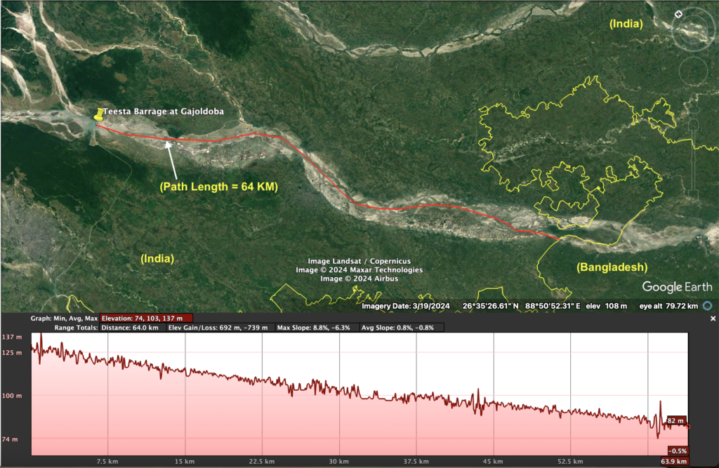
Figure 4: The Teesta barrage overview with path length. Imagery date: 08 April 2023. Source: Google Earth Pro.
Figure 4provides a larger geographical view of the Teesta River, marking the Teesta Barrage at Gajoldoba. The path length of water diversion is shown as 64 kilometres from the barrage towards Bangladesh. The lower part of the image shows an elevation profile of the river path, demonstrating the gradual decrease in elevation (from 130 to 82 metres) as the river approaches Bangladesh. The diversion of water upstream exacerbates water shortages downstream, particularly in Bangladesh, where the river flow diminishes after multiple diversions.
Summary of the Figures
These images together highlight the extensive water management infrastructure (barrages and water diversion channels) constructed by India on the Teesta River. The cumulative effect of these structures is the reduction of water flow into Bangladesh, particularly during critical agricultural seasons. The figures emphasize how close these infrastructures are to the Bangladesh border, raising concerns about the equitable sharing of transboundary water resources.